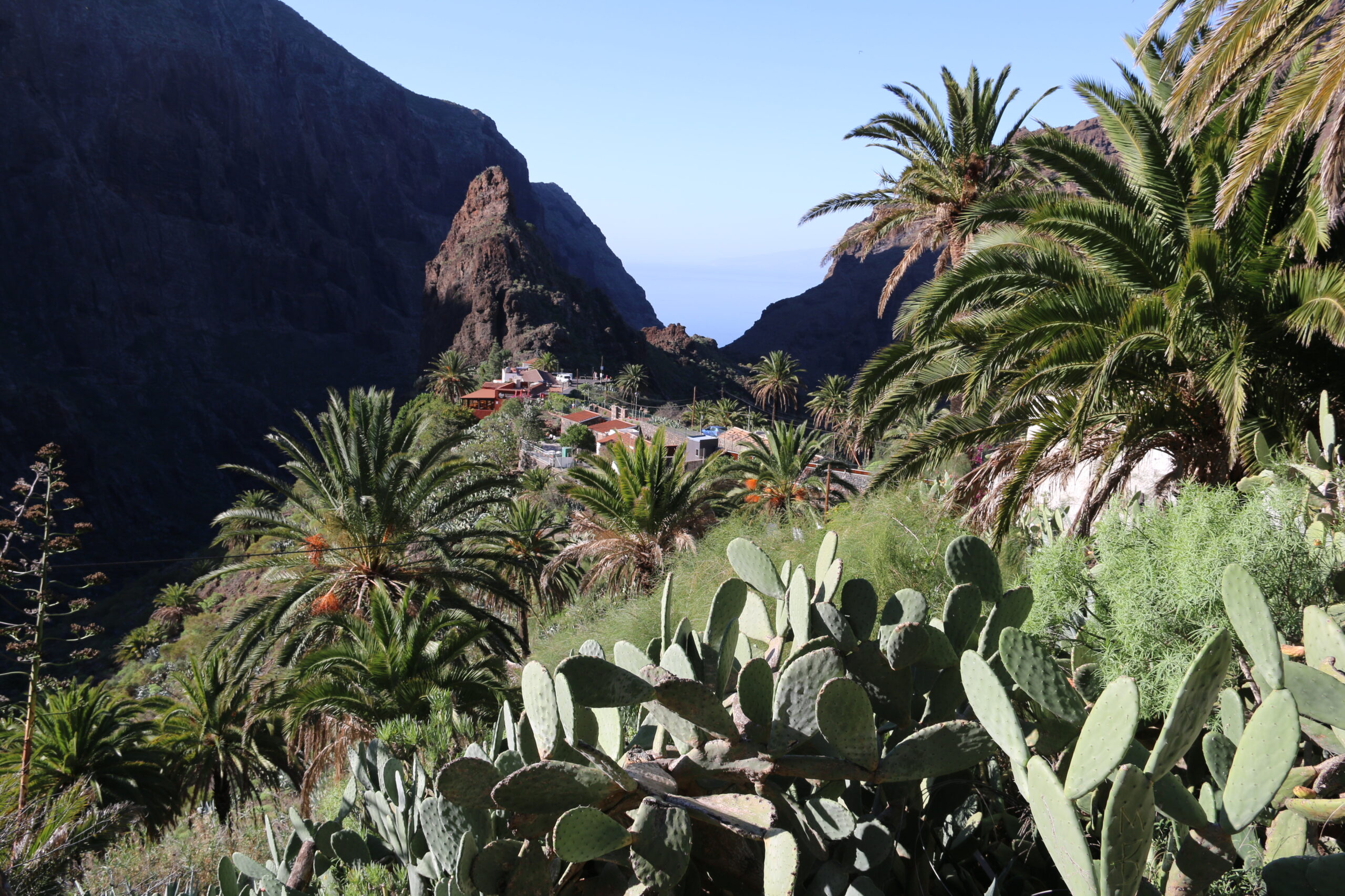
Los Gigantes sits at the foot of Teno Rural Park — eight thousand hectares of ridges, laurel forest and gorges threaded with the island’s official PR-TF trail network. You can walk from the apartment door or drive fifteen minutes to a trailhead. Rules and prices below are those in force at the time of writing (July 2026); the official platforms are linked because this system genuinely changes.
The classic routes
- Masca gorge is the headline: ~5 km and 750 vertical metres down a canyon to the sea, rated high-difficulty by the park. Permit-only via caminobarrancodemasca.com (from €40.66 non-residents, free for island residents), 25 hikers per half-hour slot, arrival by the dedicated bus from Santiago del Teide (private cars are barred for trail users), proper boots checked at the gate, minimum 1.5 litres of water, no under-eights — and a compulsory boat ticket out to Los Gigantes unless you climb back up. Book a guided package and the permit-bus-boat admin disappears.
- Chinyero volcano loop (PR-TF 43 / 43.3) — an easy-moderate ~8.5 km circuit of Tenerife’s last eruption site (1909): pine forest, raw black lava, Teide views. The area’s most-reviewed walk, at about 4.7 across more than two thousand AllTrails reviews.
- Santiago del Teide → Puerto de Santiago (PR-TF 65) is the old camino real, ~6 km gently downhill from hill town to coast, ending twenty minutes’ walk from Los Gigantes. Bus up, walk home.
- Cumbres de Baracán (PR-TF 51): a ridge walk to 1,000 metres with sea on both sides (exposed in places — not for vertigo) and goat’s cheese waiting in the Teno Alto hamlet.
- The coastal path to Alcalá and Playa San Juan gives you 8–11 km of promenade and rough shore path straight from your door; flat, shadeless, with a bus home.
- In season, the ~9 km almond-blossom route via Las Manchas to Arguayo turns spectacular from late January to early March. More codes for the ambitious: PR-TF 52/53 (laurel forest), 57, 58 and 59 around Teno.
Safety, learned the local way
The emergency number is 112, and it works with any signal on any network. Take the rescue statistics seriously without drama: island emergency services logged over two hundred rescues across the Canaries in 2025, nearly half of them on Tenerife; a rescue helicopter runs to roughly €2,000 an hour, and while the law allows billing negligent hikers, in practice you should simply carry travel insurance that covers hiking. The habits that keep you off those lists are not complicated.
Start early and carry water: lava terrain radiates heat, there are no springs on these routes, and two to three litres per person is the summer minimum. Wear real boots, because volcanic scree shreds trainers and Masca’s checkpoint literally turns sandals away. Check closures the same morning at the Cabildo’s official trail platform (tenerifeon.es); trails close for rain, rockfall and fire risk, and when Masca’s boat exit closes in swell, you climb back out.
Tell someone your route. Mobile coverage dies in the gorges; Masca’s trail carries numbered GPS markers precisely because of this. Mind the calima, too, since Saharan dust episodes spike heat and wreck air quality; postpone the strenuous stuff. The best window is October to May for the ridges, while summer belongs to dawn starts, the coast and the laurel shade. Pack a layer: Teno Alto can sit in cloud while Los Gigantes bakes.
Prefer company? Small-group guided hikes above Masca rate around 4.9 across hundreds of reviews, with south-coast pickup — and guided gorge descents handle every permit for you.
Photo: FrDr, CC BY 4.0, via Wikimedia Commons